Central Texas Showdown 2025
Central Texas Showdown 2025
I had been looking for an ultracycling event that wouldn’t involve a lot of travel, and this popped up. It was billed as 25% gravel, which wasn’t what I’d prefer, but I figured I could make it work. So I signed up. My training leading up to it I felt was OK. Could be better, but I didn’t feel underprepared. I had put 35-mm tires on my bike—1 mm larger than the frame is supposed to accept—so that was as much as I could do to make it gravel-ready. I played around with a couple of bag configurations. I was packing pretty lightly, but wound up using my Tailfin rackbag, which was overkill for the load I put in it. Plus a toptube bag for snacks, and a small frame bag for tools and gadgets.
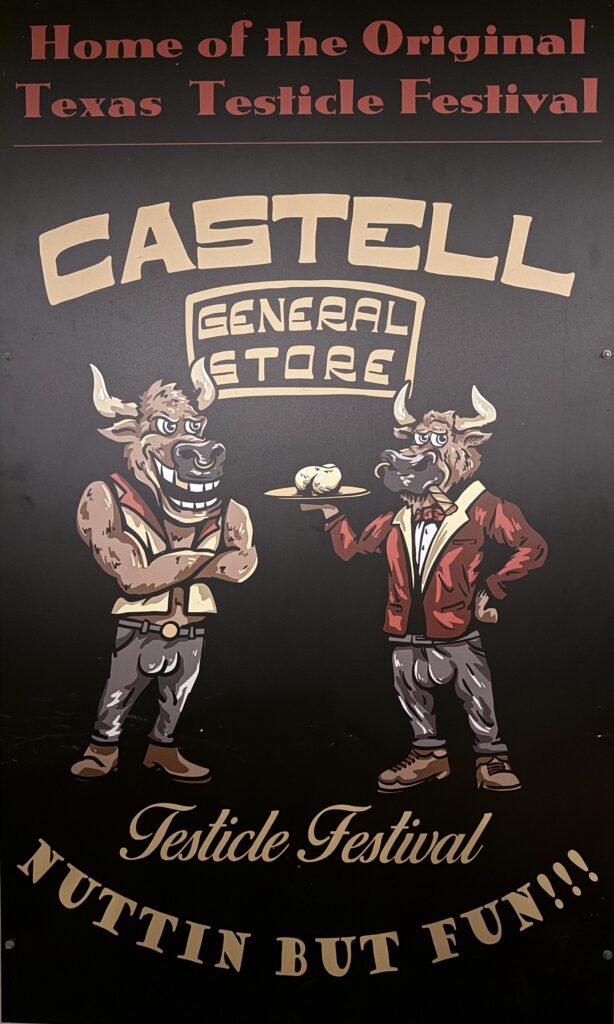
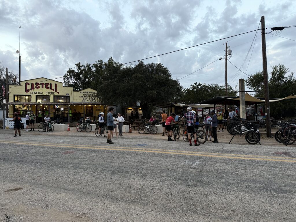
The start/end point is the town of Castell, population 13, midway between Llano and Mason. I had ridden some of the roads around there in the distant past.
Come race day, most of us arrived in Castell the night before. I missed the pre-race meeting, but I don’t think I missed anything important. Eventually I found out where everyone was camping (it wasn’t immediately obvious), and I laid out my air mattress under the stars. It was a clear night and being way out in the country, I could see all of them. I didn’t sleep well due to jitters, something other people mentioned too. In hindsight, I could have rented a hotel room about 20 miles away and slept (or not) in a more comfortable bed.
There were four events being run simultaneously: the 500-mile race (mine), a 300-miler, a 173-miler, and an 88-miler. At the start, they had us line up in that order. Only 16 of us in the 500-miler, I think (and only one woman). There was a two-mile neutralized start rollout. After that, at the head of the front pack, there were three people setting a strong pace—no one wanted to get ahead of them, but no one wanted to fall off the back of the train, either. Events like this are supposed to be no drafting, but I decided to enjoy the ride while it lasted. I knew if would break apart before long, and at the first gravel sector, about 20 miles in, it did. This and the next gravel sector both had sand traps that forced everyone off their bikes. At one point I tried walking in the grass along the edge, but that was filled with sticker burrs, which got all over my socks. I carry a tiny plier-type multitool, and it came in handy for removing them.
Even though the pack had broken up, inevitably there are people who ride at about the same speed, so you keep seeing some of the same faces on the route.
There were no resupply points on the route for the first 110 miles, so the organizers let us send bags ahead to a drop site around mile 60, and I took advantage of this. Everyone treated it like a lunch break, and I got to chat with a few of the other riders.
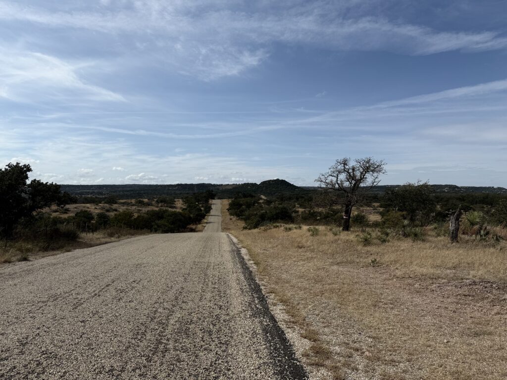
I had been maintaining a pace I was happy with to this point, but starting to get leg cramps. It wasn’t terribly hot, my hydration was OK, I took a salt cap just in case. Didn’t help. In hindsight, I think it might be because of the climbing. The route is covered with short, steep hills that keep coming at you, and I think it was getting to me. Some other riders were complaining about leg cramps too. I read something recently about how different bike positions favor your quads vs your glutes, and I must be in a quad-oriented position, because my quads were killing me, but my glutes seem to have been underused.
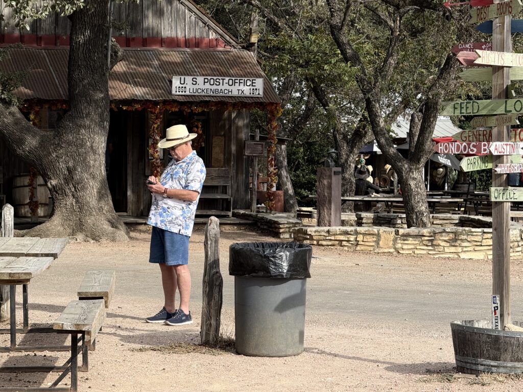
Just before reaching Luckenbach at mile 110, I could feel a bad cramp coming on—I saw a slight rise up ahead and thought “if you try to pedal up that, you’ll cramp hard.” So I stopped, and the moment I got both feet on the ground, both legs locked up so hard I couldn’t bend my knees at all. I’ve never had leg cramps like that. I couldn’t even get off the bike. Eventually I did manage to get off the bike and just sat in the grass by the road for a while. Got back on and rode the very short distance to Luckenbach, where a few other riders were already taking a break. So I did too. We talked about the weather, because a big storm was supposed to blow in that night, and people were strategizing where they’d post up. I had checked the weather forecast beforehand and had booked a cabin at the 210-mile point, so I was motivated to get there. I moved my rain jacket out of my saddlebag and into my jersey pocket so I’d be able to get at it at a moment’s notice.
I’d never been to Luckenbach before, and I didn’t realize that it’s nothing but a tourist trap. There’s a bar, a stage, a couple of souvenir shops, and a burger stand. That’s it. No one lives there.
I rode on to Comfort, where I stopped and had some real food. When I rolled out from Comfort, it was getting dark, the weather had cooled off a bit, and I was feeling stronger. My leg cramps stopped. But my poor sleep the night before was catching up with me.
Comfort is where the route for the 300-mile event diverged from the 500-mile event, so suddenly I had a lot less company on the road. Riding these utterly desolate roads in the dark was messing with my brain a little bit, so I put on some music. I hadn’t been listening to music to preserve the battery life in my headset, but at this point it felt like a worthwhile tradeoff.
At mile 170, I hit another gravel sector. Riding gravel in the dark, on a road bike, without experience riding gravel, is not a recipe for success, but I took it easy and stayed upright. I could see a massive lightning storm off to the north.
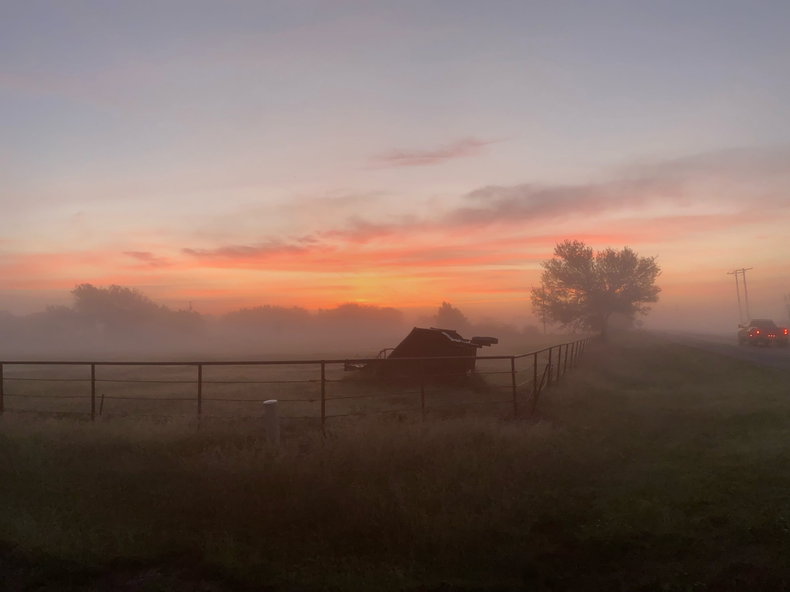
Around mile 180, the wind whipped up and the temperature dropped 20°F in a heartbeat. On went the rain jacket. A minute later the rain was coming down in sheets. A few miles later, I was on gravel again. Riding gravel in the dark, in heavy rain, on a road bike, without experience riding gravel, is also not a recipe for success, but I took it slow and stayed upright.
The rain jacket did a good job of keeping me dry, but it did nothing to keep me warm. And although it was not objectively very cold, I was freezing: when I’m exhausted, my body can’t regulate its temperature. As soon as I was back on a sealed road, I pushed it as hard as I could (which was not very hard at that point) just to generate some body heat. I had a warm jersey in my saddlebag, but it didn’t make any sense to open that bag up until I was under cover. The town of Utopia was about 15 miles away, and I’d find a gas station or some kind of awning there. I just had to make it there.
The lightning storm was now directly on top of me, with lightnight strikes less than a mile away. I felt exposed.
Made it to Utopia, found a business with a covered front porch, and spent a few minutes assessing and questioning my life choices. During this time, the rain abated somewhat, and I got rolling again. Another 14 miles to the cabin where I’d spend the night. I got there at about 2:00 AM. Although I didn’t check the tracker, apparently I was in 3rd place at this point.
The cabin was rudimentary. I had arranged with the owner ahead of time for my late arrival—he had put the room key in a drop box, along with a laminated printout of house rules in ransom-note style that basically told me not to have any fun whatsoever. I had to pay extra to have sheets. Perhaps if I had paid a little more than that, they would have supplied shampoo, and soap that didn’t leave a waxy coating on everything it touched. They advertised that they had wifi, but it only worked—momentarily—if I was standing in exactly the right spot. My cellular signal, weak as it was, was actually better.
I washed my kit, washed my socks, showered, took care of some minor upkeep, and fell asleep hard. I was awake at 6:05 even without an alarm. I would have preferred to sleep later. I packed up and got rolling quickly.
I was riding much, much slower now. Yesterday had obviously take a lot out of me, especially that final “sprint” through the rain. My goal had been to finish in 60 hours, and there was no way that would be possible at this point. I was feeling discouraged.
I had a breakfast of snacks from my toptube bag and discovered that it wasn’t quite waterproof. I really wanted a hot meal, and looking at the map, I wouldn’t find one for another 70 miles or so. Which added to my discouragement.
The rain had stopped, but there was still a lot of water on the roads, and wet roads lead to punctures: road debris adheres better to wet tires, and has more of a chance to penetrate. And this is exactly what happened, over and over again. I have tubeless tire with latex sealant in them, so minor punctures seal up in a few seconds, but I was getting a puncture every few miles, and I think at some point, I just ran out of sealant, because I had one that wouldn’t seal. It is quite likely I should have had more sealant in there to start with, but it was too late to do anything about that.
This happened on RR 337, a notoriously twisty,turny, and hilly road popular with driving enthusiasts, and I had to walk for a while before I got to a spot wide enough for me to set my bike down and work on it. I was carrying a couple of emergency innertubes, and got one mounted quickly. But I realized that if I was going to keep puncturing—and there was no reason to think that I wouldn’t—my race was over. To be honest, given the mood I was in at that point, I felt completely fine about scratching.
The organizer had some volunteers driving rescue vehicles, so I could call for help, but I’d need to ride somewhere with cellular service before I could do that. There was a crossroads with a store about five miles ahead, and I reasoned that it might have a signal and food, so I made that my destination. It did have a signal, it didn’t have much in the way of food I’d want to eat (it had plenty of cheap beer). I managed to get a message through to the organizer, and one of the rescue volunteers, texted me that he’d pick me up.
One thing about this event that I didn’t fully appreciate beforehand was just how remote it was. I’ve ridden on a lot of remote roads in Texas before, but this sustained disconnection from the rest of the world was different. Riding for an hour and maybe seeing one other person. Cellular coverage being the rare exception, not the norm. Resupply points being so infrequent.
Photos of the event by a real photographer here.