Done for the day in Tallahasse…
Done for the day in Tallahassee
To make Juan Williams more comfortable, I encourage Muslims to wear headscarves, k’fiyas, and burqas emblazoned with Old Glory.
[sgpx gpx=”/content/gpx/st2010_30.gpx”]
Started: Oct 21, 2010 7:23:15
Ride Time: 8:00:49
Stopped Time: 1:51:32
Distance: 115.22 miles
Average: 14.38 miles/h
Fastest Speed: 32.45 miles/h
Climb: 2811 feet
Calories: 5496
Hello, my name is Adam, and I think I may be turning into a distance addict.
My plan when I started today was to finish in DeFuniak Springs, which would have been an 85-mile ride. A perfectly respectable distance. When I arrived, it wasn’t even 3:00 PM yet, and I felt like that was just too damned early to quit for the day. Plus the fact that for the first 70 or so miles of my ride, I just couldn’t get into a good groove. My legs felt heavy. This might be exhaustion, it might be that rotten fried-oyster po’boy from yesterday having an effect, I don’t know. Anyhow, when I got to DeFuniak, I took a break, changed maps (because it is the transition between Sections 6 and 7), and considered my options. The small,evocatively named town of Ponce De Leon was only 11 miles away—less than an hour—and Bonifay only about two hours. So I pressed on.
In fairness, DeFuniak looks like it might have been worth stopping at. The town is built around a small lake, with a ring road circumscribing it and some park land, ringed in turn by residences and some city buildings. Idyllic.
The day’s riding to that point wasn’t much to remark on. I could have stayed on US90 all the way from Pensacola; the ACA maps zigzag around on a bike trail and some country roads for a while, mostly to break the monotony, I suppose. US90 is actually quite good for riding, with a reasonably wide, smooth, and clean shoulder. But it’s a long straight line of nothing much. It also runs parallel to I-10 (my guess is that I-10 along here was laid along US90 intentionally), so the string of towns along the route still have interstate-exit traffic. I could often just see I-10 traffic through a row of pines.
At this point I have just under 400 miles to go. If everything goes according to plan (knock wood), I’ll be dipping my wheel in the Atlantic on Tuesday morning and be home the next day. I’ve been working out some of the tour-end logistics, and my old friend from high school, Forrest, will be coming up from his home in Miami to meet me at the end. Looking forward to it.
Only chased by one dog so far in Florida—in that respect it’s not so deep-south. But in another, it is: I’ve seen three instances of the stars and bars here so far, which is two more than I saw in either Alabama or Mississippi, and as many as I saw in Louisiana during the four-odd days I spent there.
Done for the day in Bonifay. I really didn’t mean to ride this far, but my legs wouldn’t stop pedaling.
[sgpx gpx=”/content/gpx/st2010_29.gpx”]
Started: Oct 20, 2010 7:18:53
Ride Time: 5:12:50
Stopped Time: 2:55:29
Distance: 82.53 miles
Average: 15.83 miles/h
Fastest Speed: 75.99 miles/h
Climb: 3969 feet
Calories: 3973
A fast day. The mileage above is a little low because I paused recording for a couple miles before remembering to turn it back on.
I got rolling a few minutes later than intended, but I wasn’t worried about racing the sunset today, and the fact that the day was a little warmer when I got going didn’t hurt.
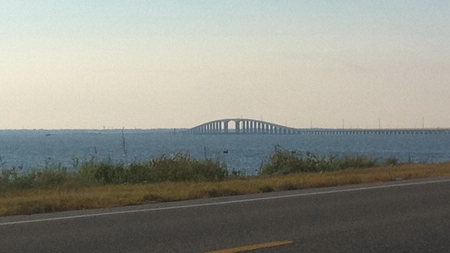
Made very quick progress as far as the Dauphin Island ferry, and then had a pretty long wait (Dauphin Island is “the birdiest small town in America”). The only vehicle ahead of me was a duallie covered in an Air Force graphics wrap. The two young airmen driving it were the support team for a memorial march by a few other airmen from Texas to Florida in memory of fallen comrades.
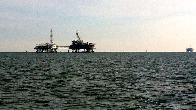
The ferry ride across Mobile Bay was about 30 minutes, and went past numerous oil rigs.
Once across, Fort Morgan and Gulf Shores were pretty much as I remembered. A lot of vacation homes up on stilts, painted in pastel colors, and a lot of condo towers, all lining the beach. More than a decade ago, I spent a couple of long weekends in one of those condos, owned by the parents of a friend. I’d had a tailwind as far as the ferry; now I was bucking a bit of a headwind but still making good time. But I was also feeling really hungry. I passed by a few fast-food chains that I wasn’t interested in, and came upon a clearly local seafood place.
Back in college, I took a trip to New Orleans and had a fried-oyster po’boy. It was one of the best things I’d ever eaten. This place had fried-oyster po’boys on the menu, and against my better judgment (deep-fried food just doesn’t make good fuel when I’m riding), I ordered it. It was awful. Complete waste. And now I’ve used up my cadmium and mercury allotment for the next decade. But getting some food in me—even bad food—re-energized me. I pushed on and made the Florida border, and then the edge of Pensacola in very good time. At one point I noticed that the ACA map seemed to be taking an unnecessary detour; i decided to try the obvious direct route. I quickly found out the reason for the detour: the direct route was a busy two-lane road with no shoulder. I turned around and got on the route like a good boy, chastened.
I had booked a hotel room for tonight through Priceline; unfortunately I didn’t research the location, and I’m in an anonymous interchange-land filled with chain businesses. Could be anywhere. The best I can say is that I’m well-positioned to continue with the route tomorrow, which will take me to DeFuniak Springs and the beginning of Section 7. Home stretch.
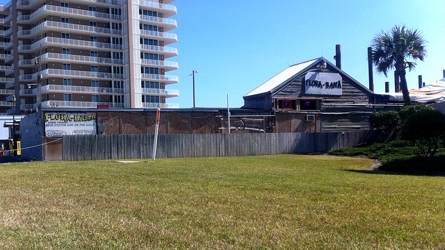
This place’s schtick is that it straddles the state line. At midnight, all the customers get herded over to the Florida half, because of the different liquor licenses.
Alabama has wheel-eating storm-drain grates. Florida has wheel-eating potholes. #acasotier