Hey, look, I ticked over 2000 …
Hey, look, I ticked over 2000 miles today. #acasotier
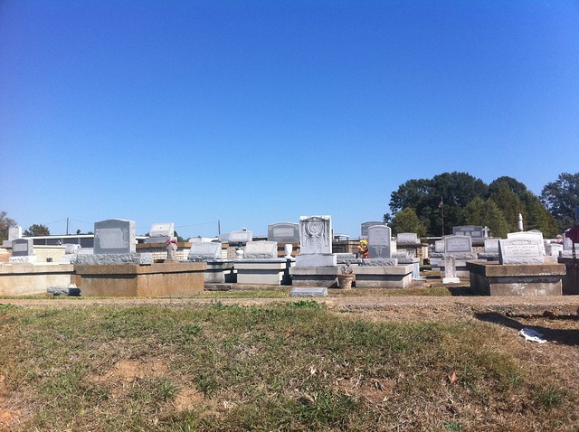
Done for the day in Simmesport, on the banks of the Atchafalaya. Wish there were a better place to stop, but there ain’t.
[sgpx gpx=”/content/gpx/st2010_24.gpx”]
Started: Oct 15, 2010 7:39:17
Ride Time: 7:48:38
Stopped Time: 1:02:39
Distance: 106.03 miles
Average: 13.58 miles/h
Fastest Speed: 35.89 miles/h
Climb: 2755 feet
Calories: 5294
Started the day with Jerry, my Warm Showers host, fixing me an omelette that wound up powering me through my longest day yet—though not my hardest, not by a longshot. The distance shown above is wrong—more GPS flakeouts. My actual distance was 111 miles.
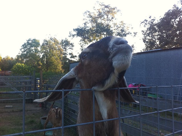
He also served me some raw goat milk from their goats. Carol had explained to me that it was contact with male goats that made goat milk goaty. She keeps her goats segregated, and so the milk she gets isn’t goaty. That’s what she told me, but I was skeptical. Skepticism: unfounded. The milk really just tasted like milk. A bit richer—I think there was more fat content than I’m used to—but that’s the only difference I noticed.
I got rolling when the sun was out, but not quite shining over the trees, so my first few miles were in shadow and really cold. If I had been smart, I would have stopped and put on my tights (and if I had been smarter, I would have had full-finger gloves, too). I wound up getting a bit of a cramp in my right calf that didn’t work itself out until nearly the end of the day.
The day’s riding was almost featureless once I crossed into Louisiana. A few trees, but mostly flat farmland. I think there’s a lot of rice cultivation here.
Roads varied between exemplary and poor, and just as one road will have very different qualities as it crosses different counties in Texas, so too here as it crosses parishes. On balance, the roads were pretty good. When I stopped for a snack in DeRidder, I got to chatting with someone who asked how many miles I could ride in a day. I told him I could cover 110, but could probably do more with favorable wind and good road surface. He replied “So about 70 in Louisiana.” From what I’ve seen, the roads aren’t that bad.
With nothing to slow me down and nothing to slow down for, I made good time, and in fact was averaging over 16 mph on the last 25-mile stretch between Oberlin and Mamou. In fact, I was feeling fresh enough that I considered pushing on an additional 15 miles to Ville Platte, but decided against it.
So I’m in Mamou, in a curious hotel. The building is pretty nice. The interior was recently redone with quality materials. But my room is just small enough that I can’t open the bathroom door without banging it into the bed, and even weirder, the room has no windows.
After four days back on the road, I’m a little farther than I had planned on being after five. I need to spend some quality time with my maps and re-figure my daily targets.
Done for the day in Mamou LA. How could I not stop in a town with a name like “Mamou”?
[sgpx gpx=”/content/gpx/st2010_23.gpx”]
Started: Oct 14, 2010 7:14:23
Ride Time: 6:55:29
Stopped Time: 1:19:09
Distance: 95.79 miles
Average: 13.83 miles/h
Fastest Speed: 26.56 miles/h
Climb: 1630 feet
Calories: 4718
Rolled out at the crack of dawn this morning. The entire Indian family that runs the hotel where I stayed turned out to wave me off. With all of the hotels run by Indians across the rural US, you’d think maybe one or two would open an Indian restaurant to go with it. Man, I’d be all over that.
East Texas is the land of loose dogs: I was chased by eight before I even took off my cool-weather jersey this morning—though none after, oddly enough. Connection?
Apart from a few miles here and there, I spent almost the entire way on roads with exemplary pavement. That, and the walls of trees that shielded me from winds helped me speed along and knock out 70 miles in exactly five hours, which is a good clip when touring. At that point I was in Silsbee, which has an actual Italian restaurant where I stopped for lunch. Pasta is a staple food for cyclists, and it’s a little frustrating not to be able to find it more often.
I was also in the land of the logging trucks. The westbound riders I met in Sanderson had told me about riding on roads with no shoulders and having logging trucks blast past them with no clearance. I’m pretty sure I know which road they mean—I rode on it yesterday—and I must have gotten lucky, because the logging trucks I saw passed me with plenty of clearance. Maybe it’s the trike. At one point l saw a logging truck heading one way, and a flatbed truck stacked tall with new shipping pallets. Wish I could have gotten a picture of that. Later I saw the plant where the pallets came from, its yard covered to a depth of two stories with pallets.
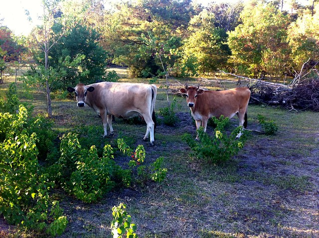
After lunch, I pushed on another 25 miles on US90. The riding here was less pleasant, and the wind was hitting me full-strength, so it was slowed as well. But it brought me to the home of Jerry and Carol, my Warm Showers hosts. They have a working farm, mostly raising goats for milk and chickens for eggs, but they also have horses, a burro, cows, and guinea fowl. Their home seems to function as a social center, with friends dropping by unannounced at all hours.
I’ll be crossing into Louisiana tomorrow, but I felt like I was already in a different state today, and was momentarily surprised when I saw a TxDOT vehicle on the road. It occurred to me that it’s preposterous that West Texas, Central Texas, and East Texas are all the same state. They feel so different.